Hiking the Fundy Footpath

Before you start planning, make a gear list!  I have mine accessible at this link.  This is the gear list I had for the Appalachian Thru-hike I completed, and my gear does not deviate much from it.  I would not bring the cold weather gear, as it is not applicable on the Fundy Coast.
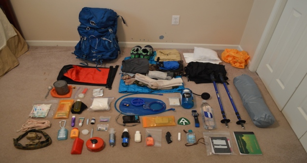
Gear page

01_ATgear_olivier_750x400

Hiking the Fundy Footpath is beautiful, remote, challenging, and inspiring.  But above all else, it’s an adventure!  I did a ton of research before setting out on this one, and I have written most of my findings.  The Getting prepared section has some brief information.
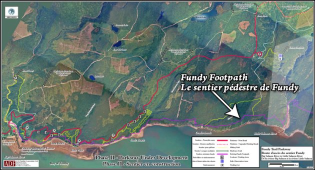
745_403_footpath_map_2009b

Maps can be purchased through this link – http://www.fundytrailparkway.com/en/the_fundy_footpath/ 

*Hint (Literally call them and request one, contact information under “contact us”).  If you are feeling ambitious, you may also ask them about taxis, I have a couple listed under Day 1.

Getting prepared

Day 1 has all the information about where we got our maps, who we picked to take for our taxi and a way to reach them, where to park etc.  People usually leave their car at Point Wolfe Campground which is 8 km from the start (or end) of the trail.  We left our car there and taxid to the other terminus (Big Salmon River).

Day 1 – Big Salmon River to Little Salmon River 17.9 km (11.12 miles)
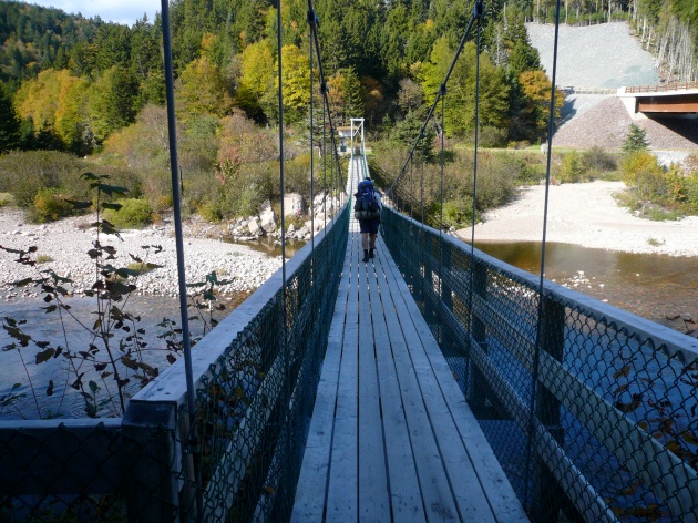
p1040098

After realizing this hike was a little more challenging than originally anticipated, which is fine for me, I had a minor melt down on day 2.  We hiked only 10 miles, but that literally took 10 hours.  I haven’t hiked that slow in God knows how long, but what a day!  There are shots of the trail and images of the map in day 2.

Day 2 – Little Salmon River to Goose Creek campsite – 16.1 km of hell (10 miles)

Day 3 we were pretty much wiped, and finished the trail by 10 am.  2 days and 4 hours.  Not bad!  But the real reason we hurried on day 3 was hunger and the thought of hot food and all those lobster rolls all around the area.  New Brunswick has some AMAZING seafood.

This section also has some information and pictures regarding finding the end of the trail, as you cross Goose River, crossing over into the approach trail.  They don’t exactly interconnect immediately, and you may want to read about it before hand.  The map wasn’t exactly informative.

Day 3 – Goose Creek Campsite to Goose River (ending) to Point Wolfe Parking Lot – 15.3 km (9.5 miles)

Afterwards, we opted out of the immediate hot showers available at Point Wolfe Campground, and instead traveled to Alma 5 minutes away.  Alma is a quiet little touristy town chalk full of seafood. Here is some info on Alma, although I found asking locals was the best way to get what I wanted.

http://www.tourismnewbrunswick.ca/Products/V/Village-of-Alma.aspx

Fundy Footpath – Day 3

Looking to go on an adventure?  Get the gear first!

Visit my gear page here for questions about gear.

1313902.large

Goose Creek Campsite to Goose River – 7.4 km (4.6 miles)

*NOTE*  An additional 7.9 km (4.9 miles) is required to actually FINISH the trail and get to civilization.  This is the “mandatory approach trail”.  The hike from Goose River to find the approach trail is NOT explained well in the guide, and I recommend reading the bottom for help with navigation. 

Total Day 3 – 15.3 km (9.5 miles)

Total hiked after completion – 49.3 km (30.6 miles) TOTAL.

We made the 9.5 miles by 1 pm, crushing the day, because.. HUNGER!!!  All we could think of was, oh man – the car is right there!  9 miles away.  We can potentially get there at noon and immediately drive to eat the most food ever.  Warm showers were also on the mind.  But first, food.

We had a tough decision to make.  Low tide was scheduled for 6:51 am, we had 2 crossings to make that were 7.4 km apart, with a 4 hour window to make both.  Knowing our previous days hiking rate, and our current exhaustion level, it wasn’t looking good.  However, we had hunger on our side.  I was not about to wait until 5 pm to cross Goose River.  We were up at 5 am, and out of camp by just before 6 am.

img_7220

Crossing Goose Creek sucks.  Neither of us had water shoes, because, who has time for those.  They are too heavy for camp shoes, and I have never really needed them.  I’ve made all my river crossings to date in my boots.  THIS crossing, however, was not sandal friendly.  I immediately lost my first sandal hiking the .5 km up river to the crossing.  The mud came up to our knees.  I didn’t even bother looking for it, I was too tired.  The mosquitos were on us, the rain had started, I was barefoot, and it was only 6 am.


We made it to the crossing, a slow trickle of shallow water.  The rocks were cutting into my feet, I was ready to put on some shoes and get my hike on!  The crossing took about 20 minutes for the minimal distance, which was a little disappointing.

On the other side, however, we went beast mode.  I carry mio energy whenever I hike, which came in handy.  The hike from Goose Creek to Goose River is super easy, comparatively.

We hiked up and over to Azore Beach, it was raining, but it was still a pretty site.

We got a little worried that we weren’t going to be able to make the crossing, until we came upon 2 hikers that had just crossed it, and said the water was still below their knees.  We ran from there.  We found the river!   We found the 0 km!  It was 3 hours past low tide and the crossing was super easy.  Rock hopping.  Never got wet.  What was all this about in the book then?

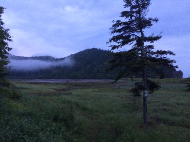
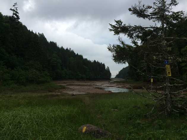
  • NOTE – Well, that’s when things got tricky.  We had to find the approach trail.  We saw some yellow blazes, assumed we were going the right way and walked for a couple hundred yards until it just ended.  We ended up in deep ocean channel, that was just void of water.  There was water in the center, with sloping hills on either side filled with mud, and a high tide water mark well above our heads 20-30 feet on either sides of us.  We realized it was 3 hours past low tide, with the safe crossing gone 1 hour ago, and started to get worried.  With no more blazes visible, panick set in a little bit.

img_7226

This is pretty much the end of the blazes.  Up ahead, it diverges left and straight.  There are footprints and paths going both ways.  The correct sequence from here is to hike straight, try to keep out of the mud, and once you get to the divergence, go straight across, up the hill, and on top of that hill you will see a log bench and some rocks.  Look very carefully and you will find a poorly marked entrance to the beginning of the approach trail.  The ONLY reason we found this, was because we saw a person.  We had walked around for a good 10 minutes in the wrong direction, and then turned around to try to find our bearings again.  This is not good to do when high tide is looming.  Hope that helps!

This section is beautiful!!!  And only 7.9 km from our car!!!  Did I mention I was hungry?  What did hot food taste like?  Is there lobster in New Brunsick?  How fast can an injured person run 5 miles with a 40 lb pack?  These are all questions in my mind as I surveyed the awesome scenery.

After taking 30 minutes to find the actual damn trail, we started on it.  IT WAS A ROAD!  We hiked the 5 miles in a little under 2 hours.

The End.  Aaaaand ready for the next one.