Hiking the Fundy Footpath

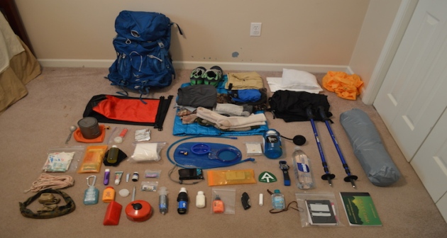
Before you start planning, make a gear list!  I have mine accessible at this link.  This is the gear list I had for the Appalachian Thru-hike I completed, and my gear does not deviate much from it.  I would not bring the cold weather gear, as it is not applicable on the Fundy Coast.

Gear page

01_ATgear_olivier_750x400

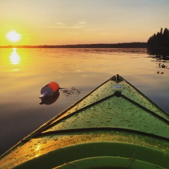
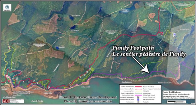
Hiking the Fundy Footpath is beautiful, remote, challenging, and inspiring.  But above all else, it’s an adventure!  I did a ton of research before setting out on this one, and I have written most of my findings.  The Getting prepared section has some brief information.

745_403_footpath_map_2009b

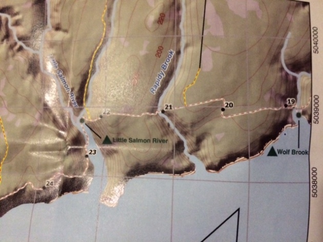
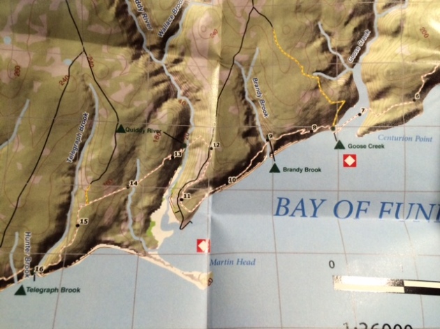
Maps can be purchased through this link – http://www.fundytrailparkway.com/en/the_fundy_footpath/ 

*Hint (Literally call them and request one, contact information under “contact us”).  If you are feeling ambitious, you may also ask them about taxis, I have a couple listed under Day 1.

Getting prepared

Day 1 has all the information about where we got our maps, who we picked to take for our taxi and a way to reach them, where to park etc.  People usually leave their car at Point Wolfe Campground which is 8 km from the start (or end) of the trail.  We left our car there and taxid to the other terminus (Big Salmon River).

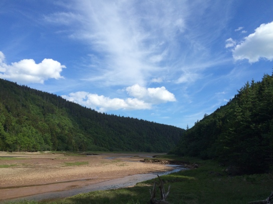
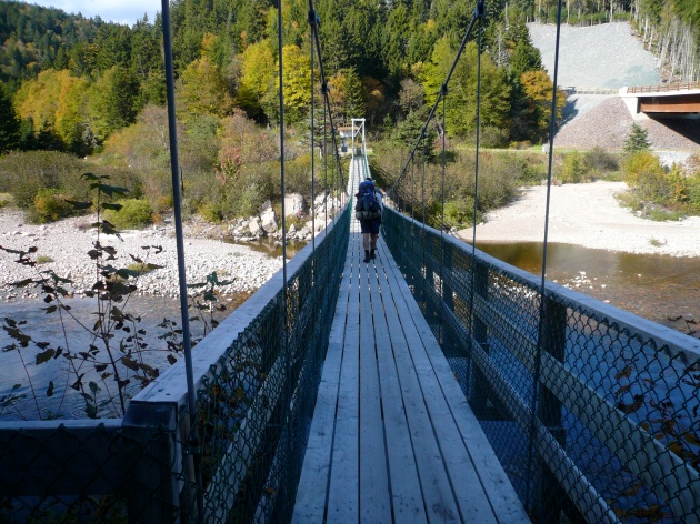
Day 1 – Big Salmon River to Little Salmon River 17.9 km (11.12 miles)

p1040098

After realizing this hike was a little more challenging than originally anticipated, which is fine for me, I had a minor melt down on day 2.  We hiked only 10 miles, but that literally took 10 hours.  I haven’t hiked that slow in God knows how long, but what a day!  There are shots of the trail and images of the map in day 2.

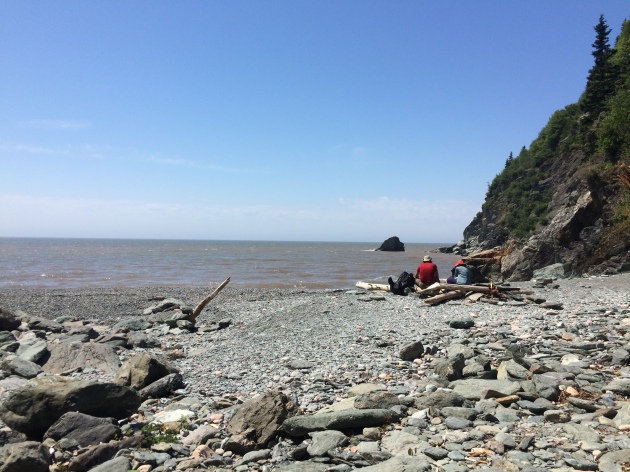
Day 2 – Little Salmon River to Goose Creek campsite – 16.1 km of hell (10 miles)

Day 3 we were pretty much wiped, and finished the trail by 10 am.  2 days and 4 hours.  Not bad!  But the real reason we hurried on day 3 was hunger and the thought of hot food and all those lobster rolls all around the area.  New Brunswick has some AMAZING seafood.

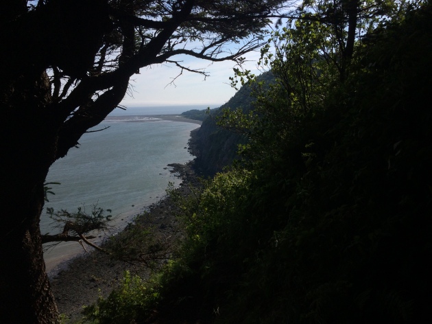
This section also has some information and pictures regarding finding the end of the trail, as you cross Goose River, crossing over into the approach trail.  They don’t exactly interconnect immediately, and you may want to read about it before hand.  The map wasn’t exactly informative.

Day 3 – Goose Creek Campsite to Goose River (ending) to Point Wolfe Parking Lot – 15.3 km (9.5 miles)

Afterwards, we opted out of the immediate hot showers available at Point Wolfe Campground, and instead traveled to Alma 5 minutes away.  Alma is a quiet little touristy town chalk full of seafood. Here is some info on Alma, although I found asking locals was the best way to get what I wanted.

http://www.tourismnewbrunswick.ca/Products/V/Village-of-Alma.aspx

Fundy Footpath – Day 2


Little Salmon River to Goose Creek Campsite – 16.1 km.  (10 miles)

Total 34 km (21.2 miles)

IMG_7203

Hell of a day!  We met some Canadian hikers doing the same trail last night, and camped with them.  They told us that today was the hardest section of all.  Today WAS the hardest day.  It was a serious roller coaster of steep, and I mean steep, uphills, marshes on top, steep descents to creeks, up and around inlets etc.  My knee had started aching the day before, so I was a little worried about it.  But hey, we made it.

Section 1 – Little Salmon River to Wolf Brook – 4.5 km (2.8 miles)

image1(1)

4.5 km.  2.8 miles.  For some reason, this took us roughly 3.5 hours!  This section was a rough way to start the day.  We woke up early, and got out of camp at 7 am, proudly packed up everything quick and thought we were going to make it to Azore Beach (we really wanted to stay there).  As you can see, the trail from Little Salmon River goes up an asskicker.  Being that it was only 7 am, we thought we’d beat the heat.  The humidity index went WAY up, and we found ourselves out of breath and taking off clothes near the top.  The top section was murky, swampy, something out of Vermont.   We made it to our first stop at Rapidy Brook, and we realized it took us almost 2 hours to hike the 2.5 km.  There is a really nice bridge here, and a great place to fill up water.

The trip to Wolf Brook was easier, except once again on top, there was a huge swamp.  We were both super tired but the silly talks about food and Canadian Panther Ticks made the journey a little more easy on the feet.

Wolf Brook to Telegraph Brook – 2.0 km – to Quiddy River 6.0 km (10.5 for the day – AND LUNCH!)

Every time we got down to a brook I got all excited!  We are making progress!  And I get to stop and take a long break.  By Telegraph Brook, I was beat!  Everything was hurting.  This was the extremely hard part, and I was in the middle of it.  We were both in shock at this point and sat down and took a good 20 minute break.  We ran into a couple of hikers hiking the other way, they gave us some info about the trail which wasn’t too positive, and had a nice little snack.  I started realizing this was going to be a long day!  Telegraph Brook is a pretty nice place to stop for a break, a nice pool of water.

IMG_7216

I’ll be honest, getting up and hiking after sitting down sucked.  Last thing I wanted to do.  We got to climb up and away from the ocean, back down to another brook, a steep up a mountain, and then drop a swift and very steep descent to Quiddy River.  I was in a lot of pain and in a sour mood by the time we arrived here, and we weren’t making the time I thought we would.  Quiddy River was a GREAT place to take the shoes and socks off and just relax and soak the feet.

Quiddy River to Goose Creek Campsite – 6 km (3.72 miles)  Total for the day – 16.1 km (10 miles).image1(2)

I realized we were going to get to Goose Creek at 6 pm, perfect time for a low tide crossing.  10 hours to hike 10 miles, I was not very happy with.  I felt like since it stayed light out until 10 pm, why not make it to Jim Brook or Rose Brook?  And the answer to that question, is because I zombie walked into Goose Creek, I don’t think I had enough energy to muster up my evening chores!  Getting water for instance.

After the section we just went through, this was not bad at all!  Yes, going up from Quiddy River sucked.  Just to come all the way back down to sea level again, just down the path a little bit.  In fact, I overheard the Canadians talking about walking down that section in their water shoes and skipping the uphill, because the road and ATV trails connect to the actual trail.  We should have waited for them!  The uphill was unrelentless.  The downhill part was awesome, about 2 km of easy downhill.  Unfortunately, this is when my girlfriend started getting the bad blisters.  We had duct taped her feet since her shoes weren’t really broken in when we started (rookie mistake 😉 ).  I have had great success with duct tape.  We were just really beaten down by this part, and we understood we were just going down the same hill we climbed up, only to be about .5 km away from where we started, while hiking about 3.

But those views though!

IMG_7217

The trail meandered along the beach for hours, it seemed to stretch out longer, I felt like this was all the maps fault.  We finally made it to Brandy Brook!   And then hiked the 1 km to our campsite.  Once we got there, 10 hours later, we realized… This is where we are sleeping tonight.  On the plus side, Goose Creek Campsites are dope looking!

The rest of the evening was quite calm if I remember correctly.  Same Canadian neighbors showed up, not many spots to sleep in, but we all fit.  Another bear box at this site.

Interested in your own camping experience?  Check out my lengthy gear page!