Hiking the Fundy Footpath
September 16, 2016 Leave a comment
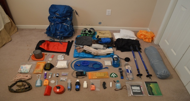
Before you start planning, make a gear list! I have mine accessible at this link. This is the gear list I had for the Appalachian Thru-hike I completed, and my gear does not deviate much from it. I would not bring the cold weather gear, as it is not applicable on the Fundy Coast.

Hiking the Fundy Footpath is beautiful, remote, challenging, and inspiring. But above all else, it’s an adventure! I did a ton of research before setting out on this one, and I have written most of my findings. The Getting prepared section has some brief information.

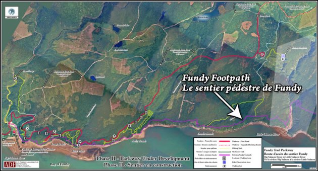
Maps can be purchased through this link – http://www.fundytrailparkway.com/en/the_fundy_footpath/
*Hint (Literally call them and request one, contact information under “contact us”). If you are feeling ambitious, you may also ask them about taxis, I have a couple listed under Day 1.
Day 1 has all the information about where we got our maps, who we picked to take for our taxi and a way to reach them, where to park etc. People usually leave their car at Point Wolfe Campground which is 8 km from the start (or end) of the trail. We left our car there and taxid to the other terminus (Big Salmon River).
Day 1 – Big Salmon River to Little Salmon River 17.9 km (11.12 miles)

After realizing this hike was a little more challenging than originally anticipated, which is fine for me, I had a minor melt down on day 2. We hiked only 10 miles, but that literally took 10 hours. I haven’t hiked that slow in God knows how long, but what a day! There are shots of the trail and images of the map in day 2.
Day 2 – Little Salmon River to Goose Creek campsite – 16.1 km of hell (10 miles)
Day 3 we were pretty much wiped, and finished the trail by 10 am. 2 days and 4 hours. Not bad! But the real reason we hurried on day 3 was hunger and the thought of hot food and all those lobster rolls all around the area. New Brunswick has some AMAZING seafood.
This section also has some information and pictures regarding finding the end of the trail, as you cross Goose River, crossing over into the approach trail. They don’t exactly interconnect immediately, and you may want to read about it before hand. The map wasn’t exactly informative.
Afterwards, we opted out of the immediate hot showers available at Point Wolfe Campground, and instead traveled to Alma 5 minutes away. Alma is a quiet little touristy town chalk full of seafood. Here is some info on Alma, although I found asking locals was the best way to get what I wanted.
http://www.tourismnewbrunswick.ca/Products/V/Village-of-Alma.aspx


