Immerse yourself in beauty as the seasons change

15 miles north of Flagstaff, on the Scenic Highway 180, you will find a dirt road called Hart Prairie Road.  This is one of the most rewarding roads to view the white aspens as they change their colors in October.  Easily one of my favorite scenic drives, I had the opportunity to visit recently and wanted to share with you all.

This takes place in Flagstaff, Arizona which is located 7000 ft above sea level.  The city boasts an impressive 12,600 ft. Mt. Humphreys that can be seen in the distance.  As you approach this mountain on the highway 180 north, you will begin to catch glimpses.  Trail off onto Hart Prairie Road after about 12 miles outside of town (hook a right) and follow as far as your heart desires.  You will soon be immersed in beauty.

img_7724img_7731img_7732img_7733img_7734img_7735img_7737img_7738img_7741

Grand Canyon – Havasu Falls – Part 2

We set out for this 3 day Grand Canyon adventure knowing the weather conditions were going to be cold and wet.  I had a couple new items of my gear for the Appalachian Trail that I was eager to test out (Ill get to that later).  It was forecasted for 48 degree high and 28 degree low with rain.  The drive is about 5 hours so we usually stay in a motel about an hour or 2 from the trail head.  We departed at 7:30 am after breakfast and it started raining/snowing on the drive there.

IMG_1344

The parking lot and down was a little better.  It was 34 degrees, so no snow, but it was lightly raining.  We descended the 10 miles to our campground

100_0556 100_0564

We arrived around 4pm, the sun was already behind the cliffs, and it was cold.  We wandered down to mooney falls to see if the camping spot I have had my eyes on was open, and there it was!  Open.

IMG_1351       IMG_1383a

It’s located just to the right of the falls, if you are looking at the falls.  We set up camp, ate, and went to bed because it was cold!

We slept in, til about 8:30 today. My hat was over my eyes so I had no idea it was morning. I actually thought I turned on my headlamp and tried turning it off, only to find it was daylight. I opened my tent, remembering that I was on the top of the waterfall and lay there for a while looking out. And there was a rainbow. Seriously?

IMG_1483

It was very relaxing, we had the entire campgrounds to ourselves. I got out of my tent to a temp in the 30s, made my way to the bathroom, and got us all water. It’s about a 10 minute walk from the top of mooney falls where we camped to the water station, and it was nice to not see anyone . Strange, but nice. Some couple coffees and oatmeals later, we had lounged for about 3 hours. It was warmed up to the high 40s, 48 had been the forecast.

IMG_1410  I tried out my iPhone 5s video slow mo here – pretty cool.  https://vimeo.com/80515139

We departed for the bottom of mooney falls around noon. It was a cliffhanger, literally. They put ladders and chains down but the mist from the waterfall made it treacherous. It was thrilling, wet and cold. My gloves were soaked from the climb down. We stayed about 30 minutes at the bottom and hiked up to havasu falls. A group of Asians were there just absolutely murdering that waterfall with photography. I stripped down to my shorts and suddenly all lenses were pointed at me. Waded out and jumped in, invigorating! It was probably 45-50 degrees out so it took awhile to warm up.

IMG_1461    IMG_1484 (Don’t be fooled, it’s in the 40’s, the water is always 67 degrees-ish though!)

When we were all dry we headed to the top of the falls to see if we could steal some sunlight, but it was already behind the canyon.. I headed back to campsite, threw on some sweats, ate dinner and the we drank some jack and played cards. Goodnight!

Waking up Monday was surreal, the sun was shining, it became 50 degrees and we set for the top of the cliff.  Made it up after about 5.5 hours.

The gear I had recently purchased and got to use –

MSR Hubba 1p tent – rainfly worked perfectly did not get wet

Thermolite reactor 20 degree synthetic bag liner – I had a 40 degree sleeping bag, and was able to keep warm during the cold nights, great purchase.

Thermarest Neoair Xlite regular (12 0z) Sleeping pad – Seriously light and small, I have heard complaints about it being noisy, but we were camped next to a waterfall, couldn’t hear anything.  Did well in the cold, comfy!

Rain jacket – Patagonia Torrentshell – No complaints, was able to keep baselayers of smart wool and just this jacket to keep warm.  Kept dry til I went swimming!

Still have a lot of work to do/gear to get before hitting the trail in March, but this was a nice exercise in the cold!

Flatiron Mountain (4860 ft)-Siphon Draw Trail

I finally had the chance to hike Flatiron!  I have been meaning to do this hike for quite sometime now, hearing how beautifully strenuous the hike is.  At just under 3000 ft elevation gain (most of which is in the last mile) and just over 3 miles one way, this proves to be a very tough hike!  Located in the Superstition Mountains (some of the most beautiful desert scenery located in AZ, also the easiest mountains to get lost in my opinion) this hike begins just outside of Apache Junction.  I found a day off, some interested people, and we met at 6:45 to conquer this beautiful beast.  Arriving just before 8 am, me and 6 others set out on an adventure!

Image  What a BEAUTIFUL way to start the day!  Everything from the parking lot forward was this scenic.  We took a group shot in the parking lot and set off..  Image  The thing I love about hiking, is it brings all walks of life together.  We had a random group, but we all had the same common goal!

The hike begins with a flat path through a park leading up to the mountains.  It takes over a mile to get to the part of it that gets tough, and having all day, we took it slow.  Image  We passed by a cool little cave where a lot of people have congregated in the past.  There was a fire ring, and some graffiti.  This was our ‘almost there!’ spot on the way back.  After a while we started getting some elevation and the valley started shining with the sun.  Being Veterans day, there was no lack of people!  This is a popular spot because it is so close to the valley.  After a little while, you come across a part that you can’t help but think.. ‘Man, this would be such a cool water slide!’  It is a natural depression in the rock from the waterfall that is just above it.   This is the part of the hike that marks the point where the hike gets “fun, weird, strenuous, adventurous, scenic etc”, whatever word defines your hiking style!   Image  So we stopped for a group selfie.  Astara, front left, was the only one that had been up before out of any of us.  We were glad we had her!  It is pretty easy to get lost from the trail (I’ll come to that later).  Image (The waterslide).  Right after the waterslide, you come to a very steep incline/followed by a very steep decline.  We stopped for snacks and waited to regroup.  At this point, it is VERY easy to lose the trail.  Stay to the right, look for the marked blue blazes, arrows etc.   Image  (A very cool silhouette of Astara refueling).  After this, the mountain basically just kicks your ass.  It gets steeper and steeper, climbing very rapidly up into the dome of Flatiron.  Image  There are cairns marking the path (rocks piled on top of eachother) to help mark the way.  If you lose site of rock piles and blue blazes after a while, turn around..  This was a very colorful look out at the valley.  Right after this you get to a bouldering section (about 15 ft high) that requires some sort of rock climbing.  It’s a little difficult to get up and down if you are new to bouldering.  However, you are basically at the top, so don’t turn back now!

Image  (The dome of Flatiron).

We got to the top, sat down for a well needed rest, took some photos and enjoyed the scenery.  There is a peak to Flatiron, another 3/4 of a mile, we did not make it there.  We visited the plane crash memorial that happened 2 years ago almost to the day.  We explored.

Image Image (We made it)!  After some exploring and photo sessions we headed back down.  We made pretty good time on the way down, but this hike was a knee killer!  It was one of the girls in our groups FIRST TIME hiking.  Front right in the photo above.  She did AMAZING, we were proud.  It is always nice to get someone out away from the ordinary.

On the way down we would wait to regroup, and my friend asked me if I heard a girl that was yelling for help, sounded like she was lost..  We could hear her, we just could not see her.  About 45 minutes later, we were almost to the waterslide, I saw a girl scrambling down another ravine towards a pretty cliffy section..  That was her!  We yelled over to her, ran up to where she was and led her back to the trail.  Like I said, the Superstitions are a very easy place to get lost in.  She was day hiking by herself and lost the trail.  Scary!  Her name was Jesi, a very nice girl and maybe a future hiking partner!  Who knows what the future will bring!

All in all, a very strenuous, beautiful hike, away from the more crowded mountains like Camelback.  An adventure for sure!

Arizona – Grand Canyon – Havasupai Falls

This is true beauty!  I would know, because I researched it on the internet haha.  This is one of the images that comes up if you google ‘havasupai falls’.  Image  SO PRETTY right?  Well I visited, and it is not far off!  This trip is WORTH it, believe me.

I made this trip last October (one of the best months to go) because the weather is a lot cooler at the top (IE not 110 degrees).  I was itching for this hike, so I reserved a spot (a must) for four and started calling my friends.  I ended up bringing Danger Dan and his girl friend, and my hiking buddy Erin.  A great group!  I had to borrow most of the gear I brought for this, because sadly I don’t own too much camping gear.  I borrowed a pack, sleeping bag, light, sleeping pad.. well just about everything.  I DID have hiking shoes ;).

We were all set to leave the next morning, time to pack!  And pack I did.. with waaay too much fun.  My pack weighed in at around 40 lbs.  Amatuer..  Image (My pack left, and Erins pack right).  We left and started the 6 hour drive from Phoenix towards the Grand Canyon.  We decided it would be best to stay the night at the hotel just before the Grand Canyon (about an hour from the trail) and get up early to hit the trail early.  We had breakfast around 6 and hit the road at 7.  We arrived around 8 am.  This was one of those hikes that was beautiful just being in the parking lot!  Image

We hefted our packs on our shoulders and began our descent.  *This trail is 13 miles each way, beginning with a 2,000 ft descent of about 2 miles, the rest of the 11 miles being flat.  The way back is the tough part!  The views of the descent were amazing, however.  This was the Grand Canyon, after all!  We made really good time down the descent, enjoying the views the entire way.  Image

We passed a lot of mules and natives that were working hard, bringing gear up and down from the parking lot.  The great thing about this hike is that you can pay for mules to take down all of your gear (coolers included ;).)  We did not have that luxury this time, but we were not deterred.  Image

Once we were at the bottom, the rest of the trail narrowed and felt like walking on sand.  It was actually quite tough in some parts, because the ground would give so much.  We spent a couple hours hiking through Canyon walls, it was surreal.  Image

Eventually we hit a sign that read ‘Havasupai – You’re almost there!’  Spirits were lifted!  We wanted to play in waterfalls we had read about so we picked up our pace.  We started passing creeks, rivers, as blue as you could imagine!  Pretty soon we reached a village at the bottom of the Grand Canyon.  A tribe of about 500 lives down here year round.  It is pretty crazy to think about, since everything they need has to be brought down by mule or helicopter.  They really rely on the tourism, so they treat everyone pretty nice.  We signed in at the village, and walked the remaining mile or so to the campsite, passing Havasu Falls!  It was just as beautiful, if not more awe inspiring, as the pictures on the internet.  ImageImageImageImage  We quickly hiked down to the campsite, and apparently it was crowded.  There were almost NO campsites left!  It was already 2pm, all I wanted to do was play, but I knew we had to claim some space.  We walked around uncertainly for about 30 minutes until we found a spot we could all fit, with a picnic bench.  We set up, and changed into our bathing suits.  It was play time!  ImageImageImageImageImage

We had our fun swimming, and went back to eat.  I wanted to check out the next waterfall called Mooney Falls.  The campsite is actually located between Havasu and Mooney Falls, the end of the campsite hovers above Mooney Falls.  It is about a 150 ft drop, and it is breathtaking!  We did some exploring, but ultimately did not have enough daylight or energy left to explore in full.  Next time (there will definitely be a next time) we will spend more days down there.  ImageImageThis last picture was taken from a picnic bench right next to a campsite, believe it or not.  That’s how close you are!  Scary when you think about it..

Well, it got dark too soon!  And the parties were starting.  We were too tired to partake, so we went to bed.  We woke up at 6 am and hit the trail, doing the 13 miles back in just over 4 hours.  This was exhausting.  If you have never been, please do not hike down, only to hike up the very next day.  Not only is your body going to be super sore, you do not have enough time to enjoy the waterfalls.  Give Havasu Falls what it deserves, at LEAST 2 nights.  There is a general store down there that sells ice cream and sodas, believe it or not!  The campsite has restrooms.  It’s an amazing hike, and I would recommend it for everyone!

Sedona – Oak Creek Canyon, West Fork Trail (overnight)

Go Ultralight with an Evernveew Alcohol stove starting at $38.99

West Fork Trail – 6 miles to campsite, 12 miles total.

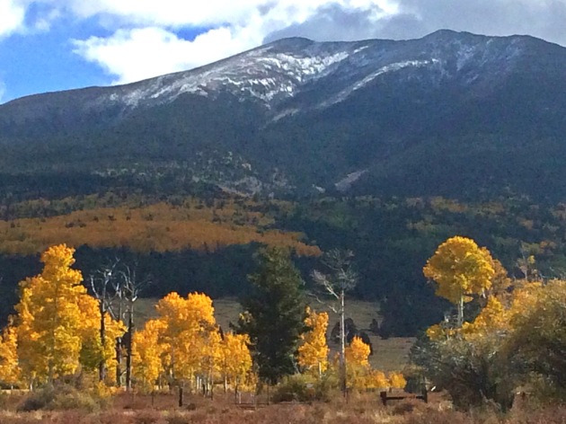
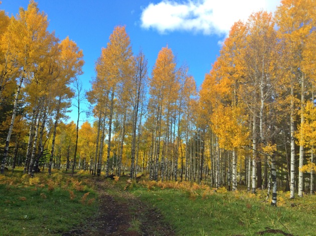
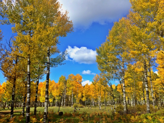
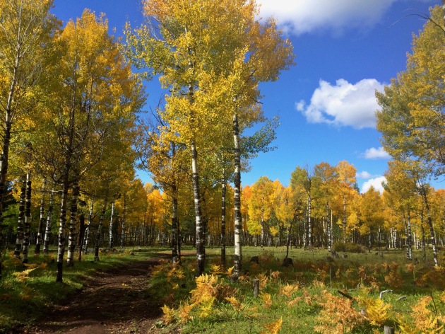
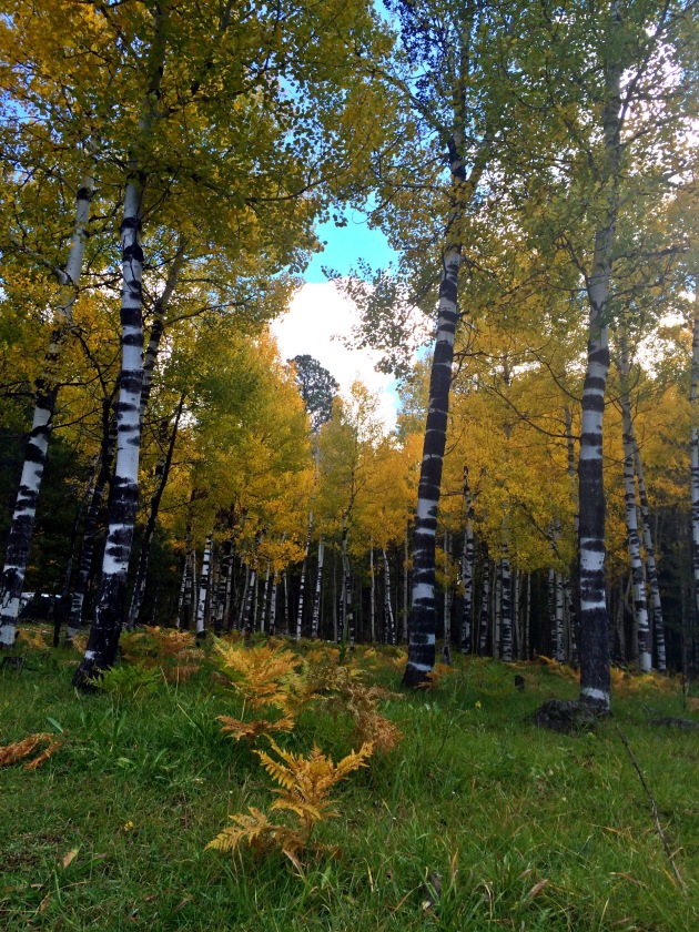
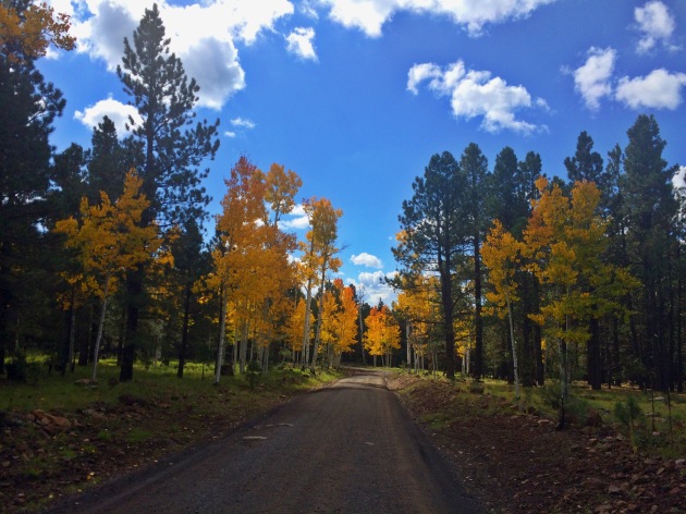
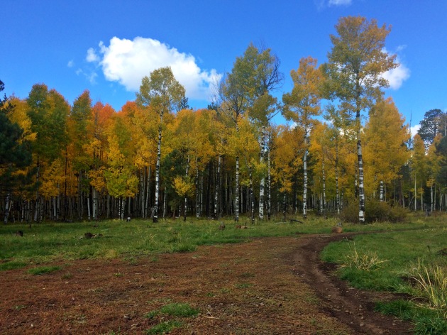
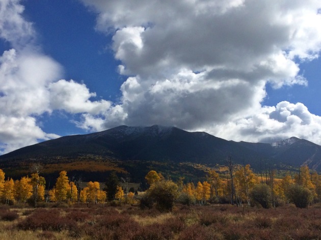
Let me just say that this is one of my favorite day hikes in Arizona..  It has a little bit of everything that Phoenix does not; water, trees, the beautiful red rocks of Sedona, etc.

True beauty in Sedona

True beauty in Sedona

I had recently purchased a new tent, sleeping bag, and stove in the hopes that I will hike the Appalachian Trail next March and needed an excuse to test them out.  So of course when I started thinking of overnight hikes, Oak Creek Canyon came up.  I called up my buddy Kris, found we had similar days off, and set off up to Sedona!

The morning of the hike, my friend/yoga instructor Astara texted me asking if I would like to go to Sedona with her and her friends (they were going for the day).  My 2 person party turned into a 6 person party.  Once in Sedona we set off on the trail, and what a beautiful day it was!

100_0450

Our group at one of the 13 creek crossings

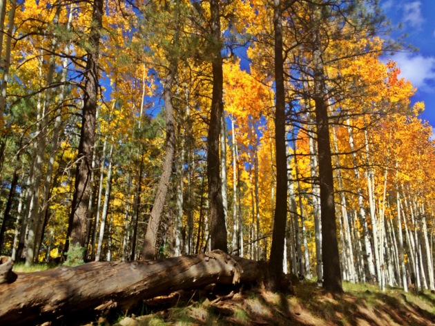
We meandered through the beautiful foliage and canyons as a group of 6 for about an hour.  The day trippers had to turn back, but not before we relaxed and meditated by the stream for about 15 minutes.  100_0455  Suddenly we realized it was 4 pm, and we still had about 4-5 miles to go, so we broke from the group and trudged on!  100_0458

About an hour later, we reached the end of the ‘trail’, where the day trekkers turn back, the trail ends into water.

If you’re looking to continue the trail from here (it’s actually 14 miles total into a road on the back end) or just camping overnight.  You’re going to want some cheap water shoes, (link to water shoes on amazon) and a bathing suit.  Basically you’re going to get wet…

I personally use Aleader quick drying aqua water shoes.  

Womens pair also available here

For like $30 and under, you’re going to end up using them more than once.  Worth it.

Anyhow, wearing our bathing suits and water shoes, we made our own path.  100_0468  This was literally the most beautiful part of this hike!  I had never been this far, the trail seemed to snake in and out of the water, with the majority of the trail being just water in between 2 canyon walls.  If you have never ventured to this part of the trail, I highly recommend it (with a bathing suit and water shoes of course).  100_0472100_0474100_0475  The water was a little cold, but once you started moving in it, you got a little used to it.  With no special attention paid to the time, we were absolutely loving this trail!  So picturesque.  100_0491.  Then it hit us, the sun sets in Phoenix around 7:40 pm, the sun sets behind the canyons around… now.  It wasn’t getting dark yet, but it wasn’t getting any warmer or easier to see on the other hand..  We started trucking it.  Climbing under and over everything in our path when we found a spider, and another, and another.  We started looking around, we were surrounded by these things!  100_0498  Big mean hairy spiders.  Mmmm!  We started being a little more careful about hand and food placement.  At this specific log, we found about 5 different spiders all where we wanted to step.  Convenient.  We hopped over Brown Recluse Dam, and came to a part we had read about.  3-6 ft of water.  Off came the packs, off came the shirts, time to do some work!  100_0501100_0506  Soaking wet, tired, getting cold, and the sun setting on us, we agreed to stop taking pictures and just find camp.  Finally, at 6:30, well after the sun had set behind the canyon we found it!  Here it is.  100_0507100_0513  We quickly set up camp, ate dinner and broke out the whiskey.  We reminisced about our last camping trip (in the backwoods of Maine) a while back.We had (in Maine) forgot to put our food bag in the trees, left a bunch of empties out and went to bed.  We woke up to something that sounded like an animal with a megaphone sniffing at our tent at 4 am.  Held my breath for what seemed to be 30 minutes, got out of my tent when I felt it was safe, and realized whatever it was ate all our food for the morning.
So with this story fresh in our minds, we went to bed without setting up a food bag, in bear country.  Needless to say, neither of us slept.  5 am we made our first cup of coffee.  100_0517  It was cold.  100_0520  Very cold.  So we had another cup of coffee, and breakfast.  It was still windy and cold.  We realized that we had to get back into that water, chest deep, and at the beginning of our hike.  LAME.  We procrastinated as long as possible (til 6:45) and started the trek.  It wasn’t THAT bad, and it was even more beautiful than the day before!  100_0531.  The sun was hitting spots and illuminating them in the distance, while the brush around us stayed dark and quiet.  True beauty.  I realized as I was knee deep in that water, walking along, that at 7:30 am, there was no other place in this world I would rather be!  100_0535.  We hit the real trail by 8 am, and turned on the burners, making it to the car at 10 am, sweating profusely, muddy and smelling.  100_0536  We passed Sedona by and decided to have a beer and burger in Oak Creek at Blue Moon Cafe.  It was a nice little place with the biggest douche of a Scottsdale server ever.  (Do you even lift, bro?!).  Ate a Cali Cheeseburger, sweet potato fries, and got a huge slice of apple pie with vanilla ice cream after.  Maybe it was the night in the woods but this was the Catalina Wine Mixers of apple pie!  POW!  Put down a delicious Nut Brown Ale from Oak Creek Brewery while I was at it.

All in all, this has been one of my favorite camping trips, and for the true beauty, I would recommend would be hikers to pass the 3.3 miles and hit the creek!  And if I had to do it again, I would have brought more whiskey, to induce sleeping.  🙂

#1 Humphreys Peak (12,633 ft.) Coconino County high point

Grit: : firmness of mind or spirit : unyielding courage in the face of hardship or danger. 

This ended up being one of the toughest hikes I have been on in quite a while.  The combination of the altitude (12,633 ft.), the mileage 4.7 miles each way (the longest 4.7 miles EVER), the elevation gains (3,333 ft. each way) creates a uniquely tough hike!  ADD mother nature, wind speeds clocking in at a strong 50-60 mph at the peak, with gusts upwards of 70 mph, and you have a recipe for how my day went!

We started the 3 hours drive from Tempe at around 7 am and made it to the parking lot just after 10 am.  It started out nicely enough in a green pasture at about 9300 ft.  It was a beautiful 75 degrees out and was supposed to get into the 80s.  I had a String Cheese Incident song stuck on replay in my head and I was loving life!

100_0401

Pretty soon we hit the trees and started huffing up the switchbacks, which weren’t even steep..(yet).  However, I was already out of breath being at 9300 ft. and not being acclimated.

100_0404

The sun was shining through the pine trees, illuminating the lush green grass, it was a very pretty hike and we were making good time!  We had passed about four other hikers by this point.  We started making some serious elevation gains, and we were seriously straining for breath, and then we came upon some interesting rock slides, possibly from an old avalanche.

100_0415 100_0416

By the time we had reached the saddle, the wind started hitting HARD!  We ran into a couple people that turned around at the saddle complaining of the cold harsh winds.  The three of us were dressed in tee shirts and shorts, with no warm clothing, one of us had only a wife beater on, so onward we pressed!

And we discovered it was now about 60 degrees max, with 30mph winds!  WOO!  Here is a picture of me posing with some snow in the distance, and a picture of what had to be an avalanche.

10656_10102574932711101_1641626133_n 9364_10102574930270991_86335431_n

But the weather would only get worse.  At the saddle we had spoken to two people who had summited earlier, and were on the way back down.  They warned us that the wind was at least twice as strong on the top, and they had to crawl on hands and knees to get to the peak.  They let us know it was very dangerous and wished us luck.  We started getting a little nervous.  But onward we push!

999730_10102574931413701_206823595_n

At this point, the trail got ‘real’.  It was no longer 30 mph winds, but 40-50, and the temperature had dropped to 45-50 degrees.  There was absolutely no tree cover as we had passed the treeline.  The only thing we could do was hike as fast as we could to the summit (which was not very fast).  The altitude had started to set in, we were around 12,000 ft by now.  We each had our turns of dizzy spells, and were out of breath just walking 30 ft.  The wind was not helping.  We had passed 9 people, all 9 had said they turned around before the summit (but had made it far) because the weather was just too dangerous.  NOT HELPING!  Here are a couple pictures of where the trail got ‘real’.

400755_10102574932426671_1614408611_n  1011940_10102574930510511_1658794237_n

But the views were too amazing, and we were too close to listen to any of those Naysayers.  That day.. We had grit.  At the 2nd false summit, the wind stopped gusting and started fiercely blowing non stop.  We were stumbling left and right, I had to put my sunglasses away, we stuck real low to the ground and just scrambled up to the summit (pictured up above on the right).  AND…

993762_10102574929737061_1610621568_n 430116_10102574929003531_2109593959_n 1013385_10102574928843851_1296510016_n

WE MADE IT!  We lasted 10 minutes at the summit, took some pictures (up above), and bounced real quick.  We crouched real low, got blown all around the place and finally got to where the wind was only 30-40mph again.  Then we hiked the longest 4.7 miles EVER to the car, cracked open some Leinenkugels and made our way back down to the 110 degree heat in Phoenix.

From there, I was a filthy mess, but I turned on to catch the last couple periods of the Bruins game.  All in all, it was a great day 🙂

1017282_10102575103224391_75132265_n

#10 Mt. Union (7979 ft.) Yavapai County high point

I was in need of some adventure and stumbled across a website that had the 15 highest peaks in the 15 different counties of Arizona.  New hikes?  Perfect!  A way out of the heat?  Ideal!  I put together a list of friends that might share my enthusiasm for impulsive adventure, and targeted our first peak.  Mt. Union.

This seemed to be the closest hike that we were capable of doing in the summer.  This was a couple hour drive, past prescott and is the highest point in Yavapai County.  After reaching Prescott we drove another 30 miles and onto a death trap of a dirt road that finally led us to our destination.  After a little white knuckling in the car, we got out and started our journey.

After a relatively easy hike we had reached the top.  Upon getting out of the car, I had realized my error of not packing sunscreen.  In fact, none of us had packed sunscreen.  Being the only person of Irish descent of the group, I was sunburned immediately.  The hike was relatively easy, and ended up at a fire watch station that is in use for the summers.
The guy running the station is more than happy to talk all day long about how he spots fires, and his travels to India and won’t be modest about stating to everyone how much better his life is than yours.

I took a little nap in his hammock, but quickly grew tired of listening to how much more this barefoot hippie knew than the rest of us, so we finally evacuated the fire tower and made our way down.  Here are some pictures of the summit, you can see for miles on a sunny day!

Image

The fire tower hammock at the top.  Enjoy yourself, but be prepared to have some unwilling knowledge bombs dropped on you.

Image

‘Dr Sues’ trees at the top.

Image

Me and Danger Dan at the top of Mt. Union.